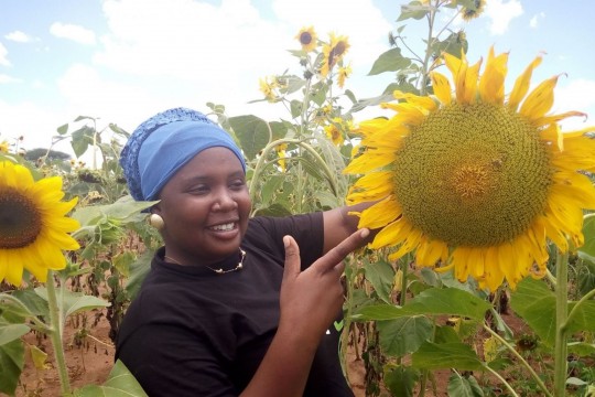
Satellite helps African farmers with agriculture
!!! EXTRA NEWS !!! 29 July 2015
We are happy to announce that Netherlands Space Office has granted this project a subsidy! Together with our partners Universiteit Wageningen, Manobi and Biomass Research we will implement the project between now and July 2018. We keep you informed on the progress.
Cultivated fields of African farmers regularly get exhausted and harvests fail due to persistent drought. Besides crops are not rotated. Certain minerals are abstracted from the soil which eventually makes the soil unfertile. Better knowledge on weather, climate and landscapes can help tackle this problem. But how do you know as a farmer when exactly you have to sow for example? Satellite data can be of help.
Hundreds of satellites are in orbit and provide us daily with information. They make mobile telephony and GPS possible but they also collect important data on for example the weather and climate and changes within landscapes. By using these collected data, together with already existing information, it’s possible to advice farmers far more precise on the best cultivation approach.
Imagine. A farmer is about to sow his land because he has heard that it’s going to rain. But the shower that was expected appeared to be rather minimal. The small plants do sprout but short after they die because deep watering has failed. A satellite gives the farmer more detailed information on the weather. If only he had known the shower was that short he would have waited until next week: when the real showers are expected.
ICS has submitted a funding proposal at Netherlands Space Office together with the University of Wageningen, Manobi and Biomass Research. ICS and her partners would like to use these satellite data for the Agrics farmers in Kenya and Tanzania, one of ICS’ social enterprises. Partner Manobi has developed an app that is used at this moment in West-Africa for the same purpose. By importing GPS coordinates of the concerning piece of land the app presents automatically a stream of present and precise information. What does the soil needs, when is the best time to sow your field and when are the showers expected. By this we can provide Agrics farmers not only with input credits and training but also with detailed information on their piece of land to cultivate.